Consolation Tour D3 Yakima Canyon to Little Naches River

Animated Map: https://www.relive.cc/view/v1vjY87M8Jq
I woke up a little after six. The sky was blue but the sun hadn't reached the canyon floor. I listened to the morning birds while I contemplated the day ahead. The Waffle Caffe in Yakima two hours away, beckoned. With just a mini breakfast of bars and dried fruit, I set off down the road. Beaufiful views abounded. I found myself stopping to snap pictures almost every mile. Traffic was light. Most of the time I had the road to myself. Despite the number of times I have driven the canyon, the experience was new. I thought about my mom who drove the canyon almost daily to attend classes at CWU to finish her BA while being a new mom and managing a marriage that was heading toward the rocks. The canyon walls seem to enclose us on our own personal journeys.
The canyon is more developed than I remembered or maybe it’s happened recently. While snapping a picture, I spied what I thought was a shed or a barn, but turned out to be a dome for a huge telescope on top of a big house set among a small subdivision of houses next to a resort. It seemed a desecration. People have lived down here for a long time, but the vacation home situation is getting out of hand in many places. The house was part of a resort development.

After I Left the resort behind, I saw the river go slack. The road left the riverside. It bent uphill. Riding a bike makes you feel elevation in your bones (or maybe quads). Looking down, I saw a water skier swinging back and forth across the boat wake. The boat and skier buzzed around the next bend, then they were back. Then I saw a dam. I never realized it there. You see more at 12 miles an hour.

The lower canyon is very pretty. Most of my experience is in the northern end. Below the dam the whitewater returns. I wonder how much power the dam is producing. It seems like a good candidate for removal, but maybe with the Yakima headwaters in a big reservoir, it wouldn’t make a difference for salmon.

The end of the canyon is marked with a beautiful portrait of Mount Adams framed by the canyon walls. I was soon in apple country. The trees have been pruned and trained into V shapes which I presume makes automated picking easier. A line of old cars lined the road getting ready for a drive up up the canyon. The next day, on 410 near Greenwater, I saw two old cars with modern cars piled behind them. I wondered if they were part of this procession.

Getting to the Waffle Caffe meant going through Selah and going through Selah means riding stroads with no thought for bikes or pedestrians. Never mind that Google Maps calls route 823 “bike friendly”. It’s not. The most confusing place was where 823 turns left. I got in the left turn lane only to discover the unmarked lane to my right allowed left turns. Suddenly I was in a bad place to be on a bike. I cut in front a car to my right to get to the right side of the roadway. Predictably, I was honked at. I hate being ‘that cyclist’. I gave the sorry wave and moved on. Leaving Selah, I finally got a bike path. Phew!


After my brunch, I headed back to the bike path leading out of Yakima to Naches. The bike path must be brand new because it isn’t on Google Maps yet. Along the way I watched the clouds on the hills and listened to an audiobook. I spotted another bike loaded with camping gear. Its owner was eating at a picnic table in a small trailside park. He was not a tourist like me. He’s homeless. He has travelled on his bike down into Oregon and California, but has been camped between Yakima and Naches for months. I wondered what his story was but didn’t want to pry.

I have never been to Naches. I recalled someone opening a fancy restaurant there, so I thought it might be upscaling and it was. I stopped at a very swank coffee shop, Cot’s Peak Coffee. Four middle aged guys on beach cruisers rode past speaking Spanish. Later they stopped in for coffee. It was nice that fancy coffee isn’t just a bougie thing or maybe I am assuming who gets to be bougie. The anglophone barista spoke what sounded like intermediate level Spanish. The customers seemed appreciative. The other barista who served me, comped me my latte and maple bar. If you’re in Naches, stop in!
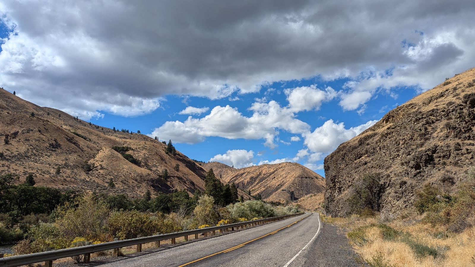
From Naches, the valley narrows to a canyon. The bike path ended. I had to use Highway 410. The scenery was awesome, but the heavy weekend traffic made me feel uncomfortable at times. I was trying to decide whether to take 410 over Chinook Pass or to use the dirt road over Naches Pass. The traffic chose for me: Naches Pass. At least there were no trucks. Commercial traffic isn’t allowed in Mount Rainier National Park and to get anywhere on 410 you need to go through the Park.

The Naches Canyon was as pretty as Yakima Canyon. Gradually, more trees began to appear. This canyon is more populated than Yakima Canyon. I predictably saw Trump signs, I also saw peace and intersectional rainbow flags. As scattered trees became forest, the number of private campgrounds increased. After miles in solid forest, I saw a 76 gas sign. This was Whistlin’ Jack’s Resort. I stopped to use the restroom at the restaurant. It was packed. Where did all these people come from? Judging from the number of ORVs, they must be here for off roading.

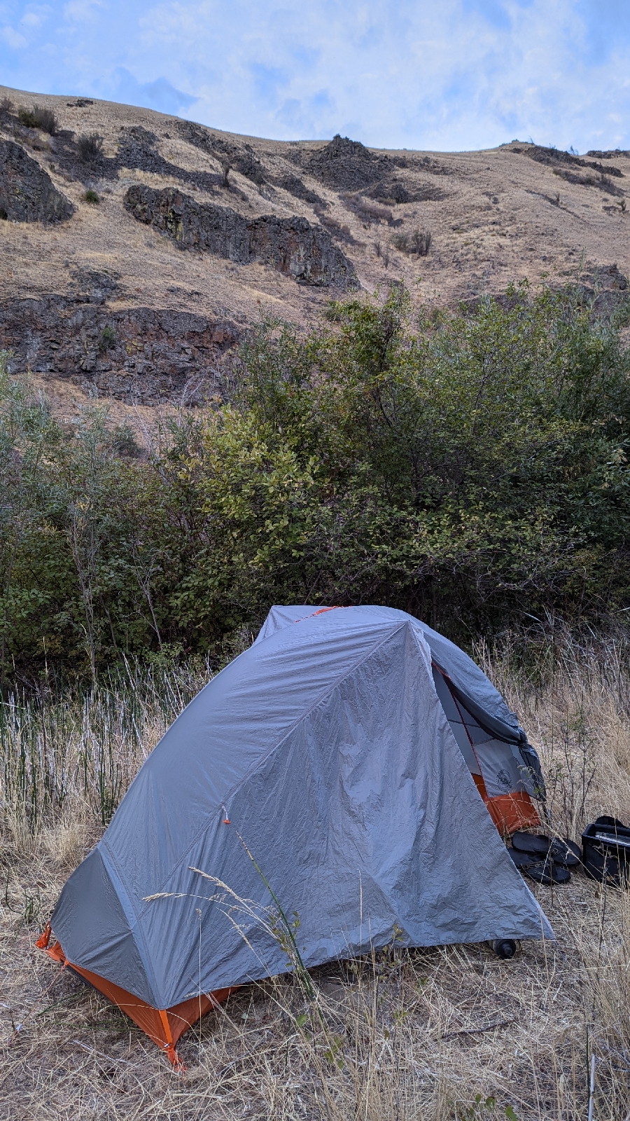
The resort is near to the spot where 410 turns west to follow the Bumping River toward Chinook Pass. I kept straight to start NF-19 up the Little Naches River. I considered staying at the official campground, but was enjoying the solitude of dispersed camping and continued on. Shortly, I found a nice spot near the Little Naches River a couple hundred feet from the road. It was visible from the road, but assumed camping here is ok and doubted anyone would bother me.

As I was unloading my bike, an elk hunter stopped to chat. He was out bow hunting. I have a lot of respect for the skill it takes for that. He was from Thorp. I told him the canyon between Thorp and Cle Elum was one of my favorite places of the whole trip.
At the place I wanted to pitch my tent, someone had left a half bottle of Mike’s Hard Lemonade, grade favor. My tired brain wasn’t working right. Instead of moving it far from camp, I tried to fling the contents into the river. Instead all the pungent liquid landed on the rocks on the bank. Even I could smell that. Every critter for miles would know, but I was near a road. Maybe it balanced out. After setting up my tent, I cleaned up the Mike’s besplattered rocks by tossing them in the river. The river probably didn’t need that, but I really didn’t want visitors.
Dinner was a little rushed as the clouds thickened, the breeze picked up, and rain threatened. The whole Mike’s thing was annoying. I was feeling a little uptight despite having a beautiful spot. I jumped in my tent just as the rain started. Along the road, all the people from Whistin’ Jack’s passed on their way up to a campground further up the river. I fell asleep to the sounds of rain on the tent fly and the occasional truck passing by.


Comments
Post a Comment